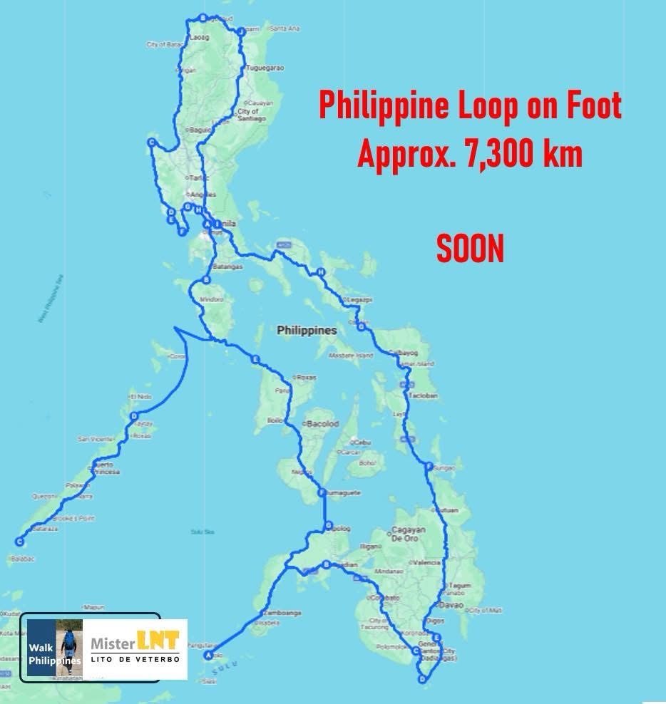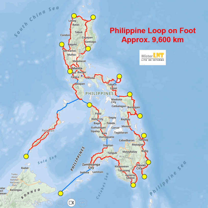
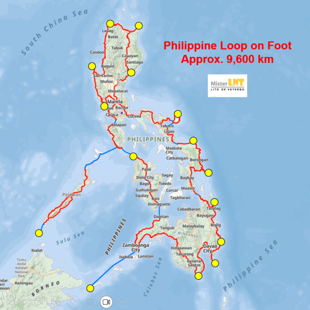
THE CONCEPT: Philippine loop on foot for a full 360-degree circumnavigation of the Philippines. Schedule TBA. Current status: Conceptualization, pre-plan stage using GAIA GPS.
What is the design concept? What is the ideal route? Where would the mandatory checkpoints be located? How many days will it take?
How much is needed? What are the challenges?
Saan ang umpisa? Will Batanes and Tawi-tawi be included in the loop?
PROPOSED OBJECTIVES
1) To spread environmental awareness and outdoor ethics thru lectures/workshops, instructor courses
1a) To apply and demonstrate low-impact, low-waste practices toward responsible travel – as in “do you disrespect the local community,” “nag-iiwan ka ba ng basura sa mga dinadaanan mo,” “what is BYO,” atbp.
1b) To complete the walk (i) without buying bottled water (by utilizing BYO tumbler), and (ii) without leaving trash across all cities and towns along the route (by applying NTB:BYOTH)
2) To survey and document pedestrian infrastructure
3) To establish the true 360 circumnavigation of the Philippines
WALK DETAILS
Walk type: Self-supported
Route type: 360 Loop (Circuit)
Route direction: TBA
Distance: Approx. 9,600 km (Previously measured at 7,300 km)
Duration: Approx. 20 months (Previously timed to be 16 months)
When (Schedule): TBA
Location: Around the Philippines
Documentation: GPS tracking using Gaia GPS app, no checkpoint or passport required
Walker/Organizer: Lito De Veterbo
INTERIM MANDATORY GPS WAYPOINTS (Starting point can be at any of these GPS waypoints)
| WAYPOINT NO. | DIRECTION Using Marinduque as the reference point being the geographical and geodetic center of the Philippines | MANDATORY GPS WAYPOINTS Mapped in a counterclockwise direction starting from the north Starting point can be any of these waypoints | REMARKS |
| N | Maira-ira Point, Bgy. Caunayan, Pagudpud, Ilocos Norte | Northernmost point of Luzon island | |
| NW | Barangay Binabalian Plaza, Bolinao, Pangasinan | ||
| NW | Bataan Death March KM 0, Mariveles, Bataan | ||
| NW | KM 0, Manila | Starting point of AH 26 (Pan-Philippine Highway / Maharlika Highway | |
| SW | Agutayan National High School, Balabac, Palawan | Westernmost point of Palawan | |
| S | Bud Bongao, Tawi-tawi | ||
| SE | Tinaca Point, Bgy. Batulaki, Glan, Sarangani Province | Southernmost point of Mindanao island | |
| SE | Cape San Agustin, Gov. Generoso, Davao Oriental | ||
| SE | Pusan Point, Caraga, Davao Oriental | Easternmost point of the Philippines | |
| SE | Laswitan Tide Pool, Cortes, Surigao del Sur | ||
| Mid-PH E | Sulangan Central Elementary School, Guiuan, Eastern Samar | ||
| Mid-PH E | Binay Primary School, Palapag, Northern Samar | ||
| E | Baldoc Bridge, Pandan, Catanduanes | ||
| N | Pozo Robo Beach Resort, Santa Ana, Cagayan |
SEA CROSSING
Appropriate watercraft may be taken to traverse bodies of water for inter-island mobility.
PROTOCOLS
- Environmental protection and community care
- NTB:BYOTH (No Trash Bin: Bring Your Own Trash Home) – No trash left across all towns and cities along the route
- BYO – Bring Your Own reusable water/food containers, mess kit/utensils, personal trash bag, eco-bag to avoid disposables
- LNT – Leave No Trace
- CLAYGO – Clean as you go
- Self-preservation and personal logistics
- Open to the public – Punta ka lang
- At own risk – Bahala ka sa buhay mo
- Self-contained – Dalhin mo ang mga kailangan mo
- BYO – Bring Your Own food/snacks and water in reusable containers. To have meals and water refill at karinderia / eateries / fast-food along the way.
- KKB – Kanya-kanyang bayad
- KKP – Kanya-kanyang punta (To the venue or assembly/meeting point)
- KKP – Kanya-kanyang insurance
SIDE EVENTS: Citations / recognition
- Cleanliness
- Search for the Cleanest LGU
- Kamote Award for the Dirtiest LGU
- Pedestrian infrastructure
- LGU with the Smoothest Road
- LGU with Available Pedestrian Infrastructure
- LGU with the Highest Walkability Rating
- Environmental awareness
- Low-impact, Low-waste Ideas Suggested by a Pedestrian
NEXT STEP: PLANNING AND PREPARATION
1. Planning
| REQUIREMENTS | SPONSOR |
| Route | |
| Route planner | Gaia GPS |
2. Preparation
| REQUIREMENTS | SPONSOR |
| GPS tracker | Gaia GPS |
| Smart watch | |
| Cellphone (With HD photo/video) | |
| Telecom service (With unli data) | |
| Outfit (including hat) | |
| Backpack | |
| Shoes | |
| Vehicle support (EV) | |
| Accommodation | |
| Start & end point – A city/town to host two-day pre-departure activities and culminating “salubong” celebration at the end of the journey – both of which highlighted by enviro-focused activities |