Objective
To enhance environmental awareness relative to Laguna Lake
- To highlight current condition of Laguna Lake
- To demonstrate the cleanliness or the lack of it on roads and communities around Laguna Lake
- To conduct clean up activities in coordination with LGUs around Laguna Lake
- To conduct LNT workshops at specific locations
Walk Details
Walk type: Self-supported
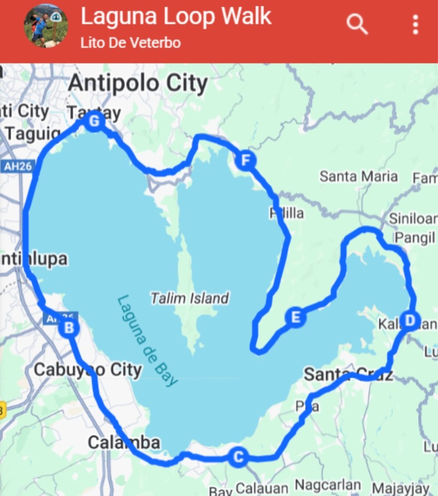
Route type: Loop (Circuit)
Distance: Approx. 184 kms
Duration: 3 weekends (every other weekend starting 10/25/2025)
Location: Around Laguna Lake, Philippines
Towns and Cities along the Route (Counterclockwise)
- RIZAL
- Taytay – STARTING POINT
- METRO MANILA
- Taguig
- Muntinlupa
- LAGUNA
- San Pedro
- Binan
- Santa Rosa
- Cabuyao
- Calamba
- Los Banos
- Bay
- Calauan
- Victoria
- Pila
- Santa Cruz
- Lumban
- Kalayaan
- Paete
- Pakil
- Pangil
- Siniloan
- Famy
- Mabitac
- Pangil 2
- Pakil 2
- RIZAL
- Jalajala
- Pililia
- Tanay
- Baras
- Morong
- Cardona
- Binangonan
- Angono
- Taytay – END POINT
Guidelines
a. Open to the public (Anyone can join at any point at anytime)
b. Self-contained
c. BYOTH
d. Able to cover cost of accommodation
Schedule (3 weekends)
| DATE | DISTANCE (km) | START | END | ACCOMMODATION |
| 10/25/2025 Saturday | 33 | Puregold Taytay Floodway | Robinsons Santa Rosa | Find accommodation in the area |
| 10/26/2025 Sunday | 31 | Robinsons Santa Rosa | Jollibee Bay Highway | Go home |
| 11/8/2025 Saturday | 31 | Jollibee Bay Highway | Kalayaan municipio | Find accommodation in the area |
| 11/9/2025 Sunday | 30 | Kalayaan municipio | Lubo Elementary School | Go home |
| 11/22/2025 Saturday | 33 | Lubo Elementary School | Jollibee Tanay Highway | Find accommodation in the area |
| 11/23/2025 Sunday | 26 | Jollibee Tanay Highway | Puregold Taytay Floodway | Go home |
| Total | 184 |
Leave No Trace Activity
10/25/2025 Sat – Leave No Trace workshop
Taytay Municipio 7am-9am
11/9/2025 Sun – Leave No Trace workshop
Kalayaan Municipio 7am-9am
Route Map